- Op-Ed
- The Mountains Pay the Bill
The Mountains Pay the Bill
From the Aravallis to Arunachal, and from Great Nicobar to Ladakh, big-ticket projects are being advanced through a system that counts megawatts, ports and contracts more readily than forests, water, consent and risk, finds Prof Ujjwal K Chowdhury.
Support Independent Media

Summary
India's development debate is often presented as a choice between jobs and conservation. The record of the last decade shows a more troubling question: who gets the contract, who gets the electricity or revenue, and who absorbs the costs when a forest, river or common land is changed beyond repair? Government data show 215,943 hectares of forestland approved for non-forest use between 2014-15 and 2025-26, with the annual pace rising sharply in the last two years. Court records, parliamentary reports and CAG audits document narrowed protections, unresolved consent, illegal extraction, project delays and steep cost overruns. These records do not prove one secret conspiracy behind every project. They do reveal an operating pattern: public authorities take ecological risks, communities lose the resources they depend on, and a concentrated circle of project developers and contractors receives the work. The counter-evidence is just as important: communities can restore water and livelihoods when they govern local commons. Development is not measured by the size of a project, but by whether it leaves people and landscapes more secure.
A woman measures development in water
In Shyampur, a village in Rajasthan's Karauli district, Anita gave rural journalist Bharat Dogra a measure of progress that no project appraisal can easily capture: the village began to move forward only after water scarcity eased. It is an ordinary sentence with a hard policy implication. Water is not a side benefit of development. It is the platform on which health, farming, livestock, education and income stand.[2]
Dogra's account follows five decades of visiting drought-struck villages. In the Bundelkhand and Patha belt, he describes women carrying muddy water over long distances, cattle left behind when fodder and water ran out, and wells reduced to dangerous pits. He also records a different kind of infrastructure: Shyampur's 18 new water bodies and 14 restored ones, a de-silted tank, water-saving farming and village stewardship. Nearly three-quarters of cultivated land there was reported to have returned to productive use.[2]
In one drought in the Patha plateau, Kol tribal women walked nearly five kilometres in the heat for two pitchers of unsafe water. Dogra's point is not nostalgia for village life. It is that a destroyed catchment can make even a newly installed tap unreliable, while watershed repair can restore water for people, farms, livestock, birds and wildlife at once.[2]
That story sets the test for India's largest projects. A dam, mine, road or port may promise energy, trade or security. But if it degrades a village catchment, fragments a forest or removes access to grazing, fish and sacred places, it can subtract the foundations of everyday life while adding impressive figures to an investment deck. The ledger puts construction costs in bold type and ecological liabilities in small print.
The clearance ledger is accelerating
Official figures reported to Parliament show that 215,943 hectares of forestland were approved for non-forest use between 2014-15 and 2025-26. Nearly 62 per cent was cleared for mining, hydropower, irrigation and roads. The annual average rose from about 14,941 hectares in 2014-19 to 19,223 hectares in 2019-24. In 2024-25 and 2025-26 alone, approvals reached 45,125 hectares, or roughly 61 hectares each day.[9] These are approvals, not a measure of how much was actually felled; still, the direction and scale matter.
A separate petition filed in the Delhi High Court alleges that the National Board for Wildlife's Standing Committee approved 97 per cent of 2,186 proposals between 2014 and 2026, involving at least 95,724 hectares. That is an allegation in a pending case, not a judicial finding. It raises a serious governance question all the same: if the body charged with scrutinising projects in wildlife landscapes almost never says no, what level of scrutiny is taking place?[4]
The eastern Himalaya saw especially sharp increases. Arunachal Pradesh recorded 6,038 hectares of diversion in 2024-26, more than eight times its 2014-19 total; Sikkim's two-year total was nearly 19 times its earlier five-year total.[9] These are headwaters and steep slopes where floods, landslides and seismic hazards make mistakes unusually costly.
A national average hides local concentration. Parcel-by-parcel clearances can miss the cumulative damage from roads, power lines, mines and reservoirs within one connected landscape.
When the law moves the goalposts
The Forest (Conservation) Amendment Act of 2023 narrowed the statutory coverage to land formally notified as forest or recorded in government records on or after 25 October 1980. It also exempts specified strategic and security projects near borders and in other areas. The government says the change clarifies coverage and facilitates national security infrastructure. PRS warns that previously recorded but unnotified forests, and some land converted before the 1996 Supreme Court ruling, could fall outside central approval.[10]
The exemptions are substantial in a border state: strategic linear projects of national importance can qualify within 100 kilometres of an international border, Line of Control or Line of Actual Control; security infrastructure up to 10 hectares is also listed, along with certain projects up to five hectares in areas affected by left-wing extremism. The Act also expands activities that may proceed without central approval to include government zoos and safaris in forest areas outside protected areas, eco-tourism facilities, and specified surveys.[10]
In February 2024 the Supreme Court directed governments to keep applying the broader definition from the 1996 Godavarman case while land identification proceeds. That interim order is a guardrail, not a final ruling on every challenge.[11] The episode shows how a law can narrow protection and leave litigation to prevent it vanishing before records are complete.
The 2022 Forest (Conservation) Rules let forest approval run alongside other statutory processes, including recognition of rights under the Forest Rights Act. The government says no final diversion order or land handover can occur until rights are settled.[12] The concern is practical: central approval can give a project momentum before communities establish what they own, use or hold sacred. A right considered after in-principle approval is harder to exercise than one considered before the site and contracts are fixed.
In September 2026, a parliamentary committee called unanimous Gram Sabha consent a major obstacle to hydropower and proposed a 70-75 per cent threshold. The Tribal Affairs Ministry replied that the Forest Rights Act contains no general clause requiring such consent for forest clearance. That reading has force: the Act's express consent provision is specific. It does not settle questions about rights recognition, clearance conditions or authority over community resources.[3]
Niyamgiri remains the clearest example of a Gram Sabha deciding a rights question. In 2013 the Supreme Court held that village assemblies should determine whether mining affected the Dongria Kondh's religious and cultural rights. The assemblies rejected the mine; it did not proceed.[13] This is not a universal veto. It is a reminder that rights tied to one landscape cannot be averaged away by counting neighbouring villages.
The Aravalli hills are disappearing twice
First the hills disappear under mining; then they risk disappearing from the maps that define protection. In 2018, a Central Empowered Committee report found that 31 of 128 sampled hills in Rajasthan's Alwar district had vanished since 1967-68. The Supreme Court ordered the state to stop illegal mining in the affected area.[14]
The CAG's audit shows the enforcement failure was systemic. Rajasthan recorded 48,486 illegal-mining cases from 2015-16 to 2019-20, with cases up 169 per cent by the final year. Satellite analysis found illegal mining in 122 test cases, covering 83.25 hectares. The audit also found irregularities at 81.68 per cent of selected weighbridges and Rs 13.99 crore in penalties not imposed for unauthorised extraction.[15] This does not prove a political conspiracy; it documents weak controls that let extraction outrun the rules.
In 2025 the Supreme Court accepted a 100-metre elevation test for defining Aravalli hills. The Indian Express reported that the Forest Survey of India warned this could exclude nearly 90 per cent of the hills. The Court put the definition on hold and appointed a new expert panel. Its August 2026 report said the range cannot be mapped by elevation alone: forests, water systems, biodiversity, habitat links and livelihoods matter too. It sought until February 2027 to complete the review.[16][17]
The Aravalli is a range, not isolated peaks. Its lower ridges help hold soil and channel water. Exclude that connective tissue and the landscape is fragmented on paper before a bulldozer arrives.
Great Nicobar has no spare island
The Union government presents Great Nicobar as a strategic port-led hub with a terminal, airport, township and power plant. The NGT record puts the project cost at about Rs 81,834 crore. The government has approved in principle diversion of 130.75 square kilometres of forest, saying 65.99 square kilometres will remain green with no tree felling and citing biodiversity plans and monitoring.[18][20] Those safeguards matter; so does the scale of change.
Great Nicobar is not an interchangeable parcel in a tree-planting ledger. Its forests and coasts sustain the Shompen, a Particularly Vulnerable Tribal Group, and the Nicobarese, alongside endemic species and leatherback turtle nesting habitat. In 2024, experts told the National Commission for Scheduled Tribes that the developer's calculation of the tribal reserve remaining protected was flawed and that tribal views were ignored.[19] The government says it followed consultation and protection policies.[18] The dispute is about who defines protection and whether local accounts of risk shape the plan before it is locked in.
The NGT upheld the clearance in February 2026, citing adequate safeguards and strategic importance. In May, the Calcutta High Court agreed to hear separate challenges to the forest-rights process.[20][32] The clearance has survived one environmental challenge; tribal-rights questions remain live.
The NGT's 2026 order also points to conditions for leatherback turtles, Nicobar megapodes, saltwater crocodiles, robber crabs, macaques and endemic birds.[31] The issue is whether those conditions can manage a transformed landscape and cumulative pressure on forest, coast and community, not whether a clearance document lists protected species.
Planting elsewhere cannot recreate a Nicobar rainforest, its species, coastal protection or the Shompen's cultural geography. Compensatory afforestation cannot make unlike ecosystems equivalent.
In Arunachal the river is not vacant energy
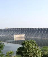
Arunachal Pradesh has declared 2025-35 its Decade of Hydropower, targeting 19,165 MW across 33 projects, against estimated potential above 50,000 MW.[23] The proposed Siang Upper Multipurpose Project is roughly 11,000-11,200 MW, with a dam up to 250 metres high. It remains at the survey stage; its final footprint and displacement list are not settled.[7][8]
For Adi communities, the survey is not abstract: it is an official entry into ancestral land, farms, river and sacred geography. Residents from more than 27 villages oppose the project and surveys. Down To Earth reported that central armed forces were deployed in two districts in May 2025 to support the pre-feasibility survey. Villagers called the deployment coercive; authorities say the project is strategically important because of China's planned upstream dam.[24] The state government later said it would not rush the study and would hear affected families.[7] Consent requires a trusted process before equipment arrives.
In September 2026, national environmental groups expressed solidarity with the Siang movement and said a CBI case under the FCRA against activist Bhanu Tatak formed part of a wider campaign to pressure dissent. That is the groups' allegation, not a court finding; it should be examined through due process.[6]
A basin-wide assessment must account for sediment, fish, flood risk, seismic hazards, downstream communities and other proposed dams. A single-project study cannot show the cumulative effect on a river system.
The Siang proposal is one part of that rush. The government's sectoral account also lists the 2,880 MW Dibang Multipurpose Project and 3,097 MW Etalin project in the Dibang basin.[23] The exact stage and footprint differ, but the combined scale makes basin-level assessment more important than any single project's clearance. Hydropower can be low-carbon at the point of generation and still impose high costs through forest loss, altered sediment, disrupted livelihoods and risk in a seismically active region.
Subansiri Lower shows the financial risk. A parliamentary committee reported that the 2,000 MW NHPC project on the Assam-Arunachal border had risen from Rs 6,285 crore to an estimated Rs 27,949 crore, a 344.66 per cent increase.[25][26] Delays, disputes, redesign and disruption all contributed; no one cause explains the rise. The public purse carries the overrun while the valley carries the physical changes.
Arunachal's revenue ambitions are real, as are India's power and security needs. But projected revenue is not realised benefit, and planned megawatts do not guarantee local prosperity. Affected people need enforceable benefit-sharing, independent safety review and a meaningful role before the dam becomes inevitable.
The Western Ghats and the sunk-cost trap
Karnataka's proposed 2,000 MW Sharavati pumped-storage project, estimated at Rs 10,240 crore, would require forest diversion inside the Lion-Tailed Macaque Sanctuary. In September 2026, Shankar Sharma reported that 142 hectares were at stake and a central expert committee had recommended against approval; the High Court stay ran through October 1. The committee cited tree felling, fragmentation and wildlife disturbance.[1][27]
Sharma said RTI records showed seven project bills paid to an identified EPC contractor over about ten months before required clearances.[1] That is not proof of a bribe or corrupt award. It does show how public spending can become a sunk cost before an ecological decision is settled, making rejection politically harder.
Proposals in the Varahi and Malaprabha catchments raise the same question: is each site necessary after comparing it with grid upgrades, demand management, battery storage and distributed systems? Batteries may not meet every long-duration need; alternatives should still be public and independently tested.
The Varahi proposal alone is described as a 2,500 MW project in the catchment around Mookambika and Someshwara sanctuaries. A separate 1,600 MW Saundatti proposal would require forest diversion in the Malaprabha basin.[1] Their status is at the planning and tendering stage, not construction. That is precisely when a comparison of storage options, forest fragmentation and watershed impacts is least expensive to do and most useful to the public.
On July 27, 2026, the Centre reissued a seventh draft to classify about 56,825 square kilometres across six states as ecologically sensitive. Previous drafts since 2014 did not produce a final settlement.[1] A region can be valuable enough to avoid casually clearing and still too politically contested to protect.
Ladakh's fragile high country
Strategic roads and mobile coverage serve Ladakh residents as well as defence personnel. The question is where and how they are built. In 2023 the State Board for Wildlife approved 25 projects in wildlife areas: 20 mobile towers, four security roads and a solar telescope on Pangong Lake's bank inside Changthang sanctuary.[21] The issue is whether separate permissions are assessed cumulatively.
A peer-reviewed study of 24 Changthang wetlands found distance from roads and settlements strongly related to the abundance of several waterbird species.[22] This does not mean every road has the same effect. It does show that access and construction are ecological variables in a high-altitude wetland system. The cold desert supports black-necked cranes, kiang and migratory birds, and recovers slowly from disturbance.
The black-necked crane is protected under Schedule I of the Wildlife (Protection) Act, and Changthang includes some of its important habitat.[22] This should prompt careful routing and seasonal controls, not a blanket refusal to serve remote settlements. The standard should be transparent mitigation with public monitoring after construction, not a one-time vote by the wildlife board followed by silence.
A road may connect a hamlet to a clinic and open a wetland to traffic, tourism and waste. Planning must map breeding grounds, water sources and seasonal grazing, then track cumulative effects.
The contractor is visible; the hidden costs are not
The phrase 'politician-bureaucrat-contractor lobby' cannot replace evidence. The record does not prove one conspiracy behind every clearance, but it does show incentives. Appraisal is often file by file; a parliamentary review said hydropower relies on only four or five contractors and recommended expanding that base.[25] That is a concentrated market, not proof of collusion.
The CAG found mismatches in Rajasthan's extraction and transit records, uncollected penalties, weak weighbridge controls and royalty revenue at risk.[15] Sharma's account of early contractor payments in the Western Ghats raises another accountability issue. Subansiri's cost rise shows how delays can shift costs to the public. Together, these records show activity outrunning financial and ecological controls, even if they do not prove every rupee became profit.
One CAG finding was especially revealing: 13 mining leases showed no excavation, yet 5.2 lakh tonnes of mineral were recorded as dispatched using 22,854 electronic transit permits.[15] A well-run licensing and weighbridge system should make such discrepancies difficult. Where extraction proceeds and the state cannot reconcile the records or collect penalties, the gap is not a theoretical externality; it is a visible loss to the public purse and a possible gain to those moving the material.
A contractor's work is measured in kilometres and bills. Lost commons are measured in less fodder, longer water walks, fewer fish or wetlands that no longer support birds. Land Conflict Watch maps about 1,095 conflicts; nearly 78 per cent involve commons.[28] Shared landscapes carry economic and cultural value that project appraisals routinely struggle to price.
The Forest Survey of India's forest-cover measure includes land of at least one hectare with 10 per cent canopy, regardless of ownership or legal status, including plantations, orchards, bamboo and palms.[30] It measures canopy, not intact biodiversity. CAG audits have found weak monitoring, survival problems and gaps in identifying land for compensatory afforestation.[29] A new plantation may add cover without replacing an old forest's water regulation, soil, species or cultural role.
The structural transfer is plain: project benefits are booked at the site and in revenue plans; losses are dispersed among villages, future generations and public budgets. Where rights are weak and ecological costs underpriced, profits can be private while risks are socialised. That is a defensible account of the lobby: not an accusation against every official or builder, but a system where a few decide and many live with the outcome.
A different kind of infrastructure
The 100 Stories of Commons archive documents communities protecting forests, wetlands, grazing land and village water bodies. It records not only what people lose but what they sustain.[5][28] Dogra's account of Shyampur belongs there, alongside Jal Sahelis who revive ponds and committees that maintain restored tanks.[2] These are not substitutes for every road or port; they show that public interest is not synonymous with scale.
India needs energy, transport, flood protection and jobs. It also needs alternatives and community rights to shape projects before sites are fixed. Basin-wide studies should precede clearance. Publish appraisal minutes, forest maps, contractor awards and payments. Test the need against less damaging options. Recognise Gram Sabha rights before costs are sunk, and measure mitigation over time in the ecosystem being changed.
For energy storage, that means comparing pumped storage with batteries, demand response, transmission and local storage against the actual duration and grid service required. For roads and security works, it means mapping the habitat first and publishing why a chosen route is necessary. For mines and ports, it means disclosing the full cost of water, restoration, carbon and community access, then auditing those promises after operations start.
A mountain is not empty because a spreadsheet omits its streams or sacred paths. A forest is not replaceable because another state has space for saplings. Those facts belong on the first page of a project report, not the last page of a compensation plan.
Anita's village rebuilt water bodies and made them work. From the Aravallis to Arunachal, ask before the next clearance: will this project make residents more secure, or will they pay for somebody else's idea of growth?
000
References
Inline bracketed numbers refer to the sources below. Government and court records are identified separately from reported analysis and advocacy claims.
[10] PRS Legislative Research, ‘The Forest (Conservation) Amendment Bill, 2023.’
[11] Supreme Court of India, interim order in W.P. (C) 1164/2023, 19 February 2024.
[16] Supreme Court of India, order in In Re: Definition of Aravalli Hills and Ranges, 29 December 2025.
[30] Forest Survey of India, India State of Forest Report 2023, methodology for forest-cover mapping.
About The Author

Prof. Ujjwal K. Chowdhury is a senior academic, institution-builder, and political analyst based out of Kolkata, India.


Latest News

ePaper
Advertisement